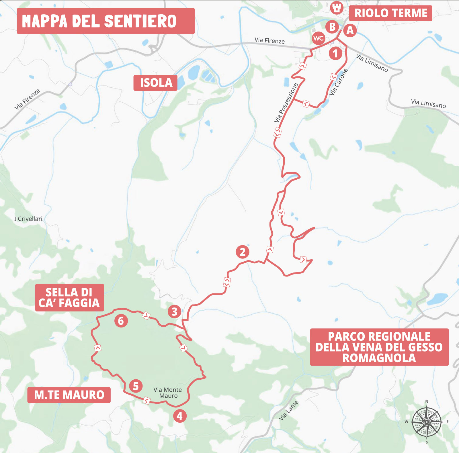
This route is part of the official hiking network "I Petali della Ginestra" of Riolo Terme. The itinerary runs near the Regional Park of the Vena del Gesso Romagnola, a UNESCO World Heritage Site recognized for the geological significance of its evaporite karst landscape in the Northern Apennines.
A loop route covering a total distance of 23.2 km through the fascinating landscape of the Regional Park of the Vena del Gesso Romagnola, leading towards its main summit.

-
Starting from the Historic Village
The itinerary starts from the thermal area of Riolo, immediately passing by the renowned Riolo Thermal Spa. From here, it continues southeast along Via Limisano and Via Laderchio, beginning the gradual climb into the hills.
-
Among Unforgettable Landscapes
As you climb towards Monte Mauro, the landscape reveals all its remarkable variety. After passing Picco Camurani, with its spectacular views over the badlands, the route continues towards the Ca' Castellina parking area, surrounded by woods and ancient caves once used for extraction activities.
Passing through Via Co' di Sasso, you reach the Church of Santa Maria Assunta of Monte Mauro and the panoramic viewpoint overlooking Monte della Volpe, among ridges, gypsum spurs, and clay outcrops.
-
The Panoramic Return Route
The return section passes through the Sella di Ca' Faggia area, offering views of the Torresina Cave, before taking Via Rio Ferrato. The final part of the route descends back towards the valley, ending in the thermal area.

Experience the Vena del Gesso Romagnola

mtb-monte-mauro-arancione.gpx
 Download
Useful information
What to know before you go
Starting point:
Start / finish point: River Park - camper area of Riolo Terme (Via Firenze 9).